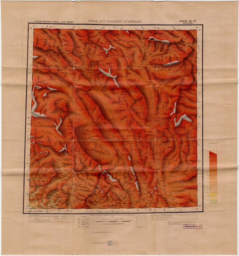
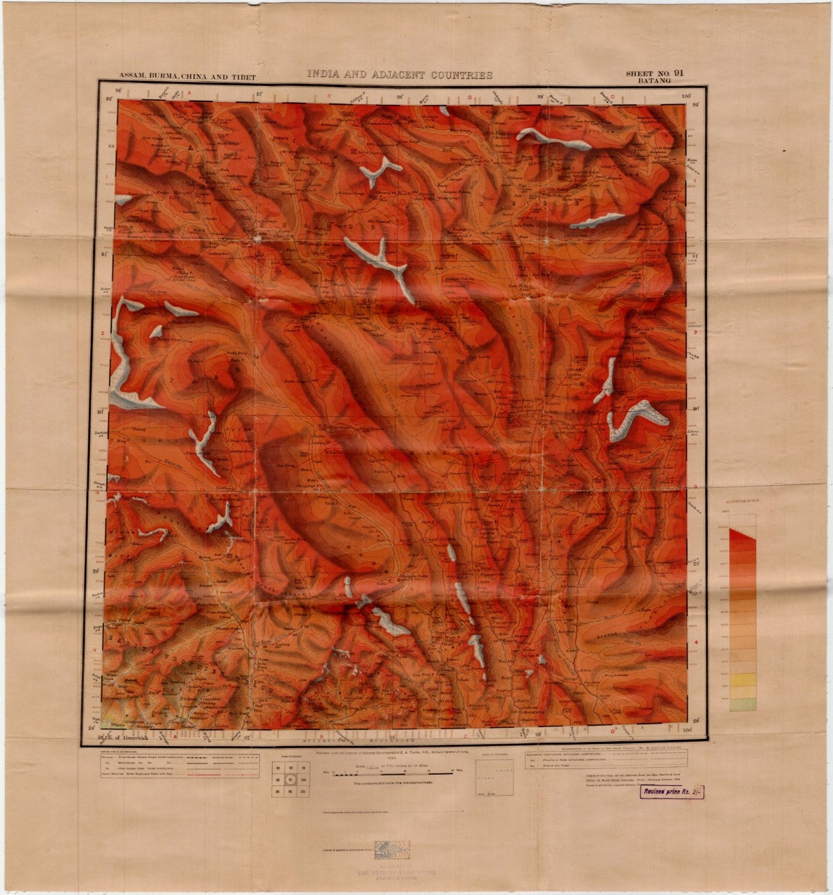
India and Adjacent Countries: Assam, Burma, China and Tibet.; Sheet No. 91 BATANG
Calcutta: Surveyor General of India, 1925. Revised Edition. Linen-backed. Calcutta, India, 1925. Color "heliozincographed" map. Measures 46.5cm x 43cm (18¼" x 17"). Backed with linen as issued (for 3 anna extra). “Published under the direction of Brigadier E. A. Tandy, DSO, Surveyor of India, 1925.” Condition: Slight edge toning, old folds. With the rubber-stamp of "Henri Vetch, The French Bookstore," Peking. Near Fine. Item #93
Detailed topographic map of the territory that would become critical in the CBI – China-Burma-India Theater – during WWII. From a historic-cartographic standpoint, the need for accurate maps in executing Allied wartime logistics cannot have been more vital. Approaches to China by land and sea had been cut off by the Japanese. As a result, the burdensome “Hump” had to be surmounted. The E. A. Tandy-directed survey that generated this map would prove invaluable in negotiating that effort. That this copy was sold by Henri Vetch adds a hint of intrigue. More than a bookstore, Vetch's enterprise was magnet for expats and travelers transiting through Peking. Vetch's also attracted esteemed Western sinologists, some of whom were published under his own imprint. In the 1930s the presence of Japanese invaders pressurized an ancient city historically imbued with an undercurrent of intrigue. One can imagine Vetch's store and the scholars it attracted became a focus of Japanese suspicion. How long was Vetch allowed to sell maps containing urgent data? Bookseller inventory R06113X2H.
Price: $250.00