![Item #6998 Seattle Guide Map [Large Full Color Map]. CARTOGRAPHY - Seattle.](https://longbrosbooks.cdn.bibliopolis.com/pictures/6998.jpg?width=768&height=1000&fit=bounds&auto=webp&v=1685984856)
![Seattle Guide Map [Large Full Color Map]](https://longbrosbooks.cdn.bibliopolis.com/pictures/6998_2.jpg?auto=webp&v=1685984856)
Seattle Guide Map [Large Full Color Map]
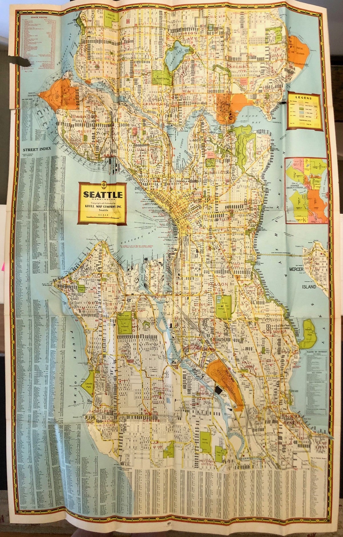
Seattle: Kroll Map Company, 1944. Folded Map in Stiff Illustrated Wrappers. Single folded sheet 22 x 34 inches printed recto in colors. Tipped into tan paper cover, titles and illustration printed in black. Cover edges a bit worn, rubbed, with small dampstain, ink notations inside front cover. A few short splits to map folds, torn away from cover. Good+. Item #6998
A detailed multicolor map featuring motor coach routes as of May 1, 1944, prominent building names including industrial facilities, numbered piers, schools, etc. Seattle's hour-glass shape is framed by the blue water of Elliott Bay to the west, Lake Washington to the west. Scale 0.5 mile to the inch. A handsome map depicting the Emerald City prior to it's post-WWII expansion. Eminently worthy of framing.
Price: $175.00