![Item #5332 [Large Color WWII Map of] Central Asia. Maps - Asia.](https://longbrosbooks.cdn.bibliopolis.com/pictures/5332.jpg?width=768&height=1000&fit=bounds&auto=webp&v=1648673389)
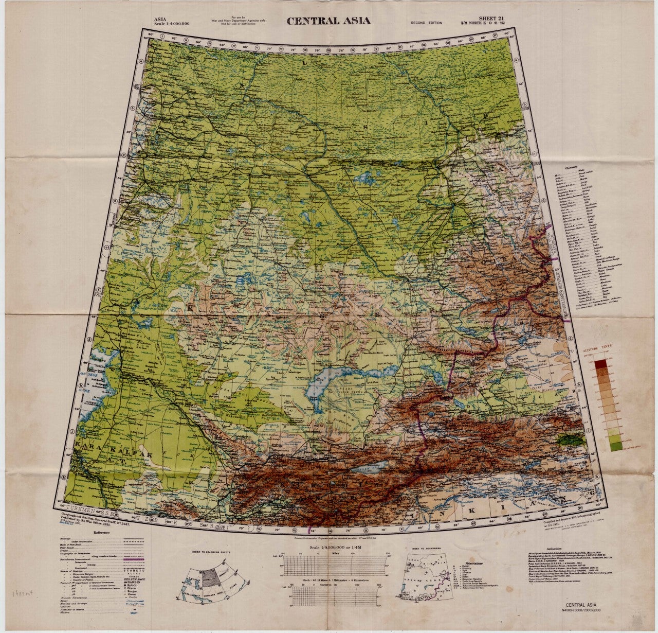
[Large Color WWII Map of] Central Asia
Washington, D.C. Army Map Service U.S. Army, 1942. Second Edition. Loose sheet. Full color map measures 29 x 29 inches. With a list of authorities (i.e., other maps consulted in the creation of this map). Glossary. Index to boundaries. Folds, as issued, and with light soiling. A bright copy. Very Good. Item #5332
First published 1931 by the War Office, this edition is labeled, "For Use by War and Navy Department Agencies Only. Not for Sale or Distribution." A vital map published the year (1942) the Japanese invaded Burma and closed off the Allies main supply route, the Burma Road. Having already controlled littoral China, supplying inland Chinese forces and the Chinese population became increasingly fraught. The region covered extends westward to USSR, southward to Northern India, and eastward to Mongolia. From the collection of Asian books and maps formed by Albert Ravenholt. On verso Ravenholt has written "Central Asia (as far as E. of Tihwa)."
Price: $225.00