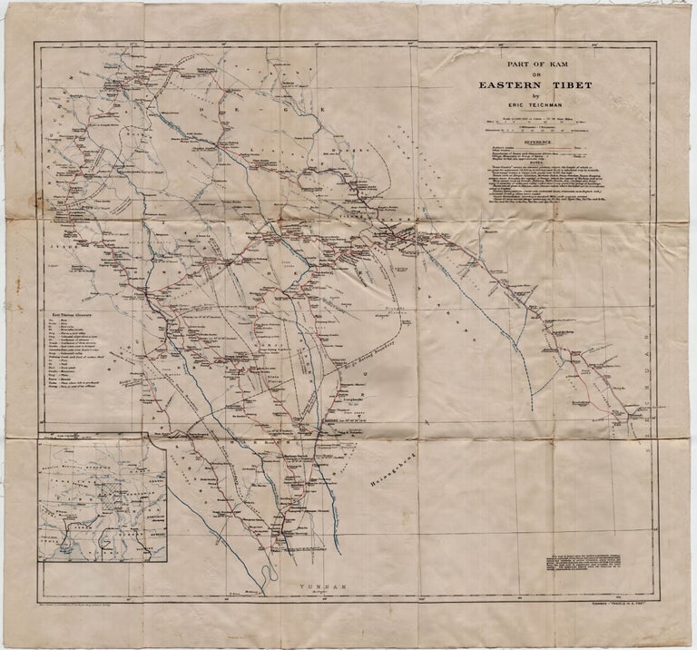
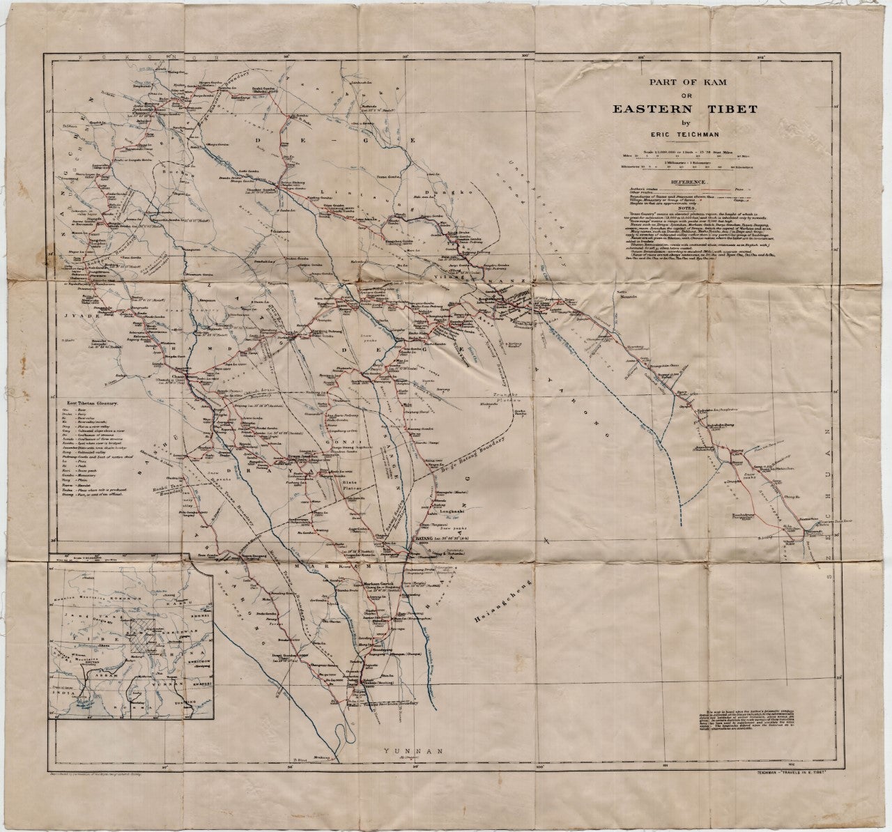
Part of Kam or Eastern Tibet
[Cambridge]: [Cambridge University Press], [1922]. Eric Teichman. Loose sheet mounted on linen. Map printed in color measuring 26.5 x 25 inches. With a Tibetan glossary. Provides Teichman's routes, as well as other routes, along with villages, monasteries or groups of farms. Edgewear, with light stains here and there. In. Good-. Item #5331
From Travels of a Consular Officer in Eastern Tibet Together With A History of the Relations between China, Tibet, and India and mounted on linen. The map was clearly used, perhaps in the field, as evidence of wear, including a split in the paper (not the linen on which it's mounted) suggests. From the collection of Asian books and maps formed by Albert Ravenholt. On verso Ravenholt has written "Teichman's Kam (28 [degrees] 25' - 33 [degrees] 20').
Price: $75.00