![Item #44 North Western America Showing the Territory Ceded by Russia to the United States [Northwestern] [FRAMED MAP]. S. Augustus MITCHELL, S. Augustus Mitchell Jr.](https://longbrosbooks.cdn.bibliopolis.com/pictures/44.jpg?width=768&height=1000&fit=bounds&auto=webp&v=1623699371)
![North Western America Showing the Territory Ceded by Russia to the United States [Northwestern] [FRAMED MAP]](https://longbrosbooks.cdn.bibliopolis.com/pictures/44_1.jpg?auto=webp&v=1623699371)
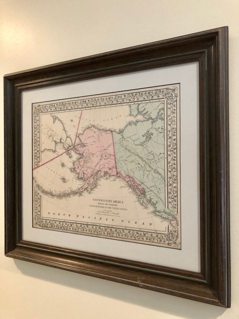
North Western America Showing the Territory Ceded by Russia to the United States [Northwestern] [FRAMED MAP]
(Philadelphia): S. Augustus Mitchell, Jr., 1867. S. Augustus Mitchell. First Thus. Framed under glass. Hand-colored map measures 14 1/2" x 12 1/4". Professionally framed and matted. Fine. Fine. Item #44
The first Mitchell map of Alaska, published the same year -- 1867 -- the land mass was sold by Russia to America for $7.2 million. "Reduced from the Map Published by the U.S.C.S. Dep." This is page 58 excised from "Mitchell's New General Atlas,… ." Attractive coloring showing the Alaska District in the context of Russia, the Aleutians, and Canada, with a corner of Washington Territory visible (Strait of Juan de Fuca and Cape Flattery), all within a handsome vine border. Map can be shipped in framed state or removed from frame and sent, rolled, in a tube. Shipping costs to be established, with no surcharge for handling -- only actual shipping costs charged.
Price: $175.00