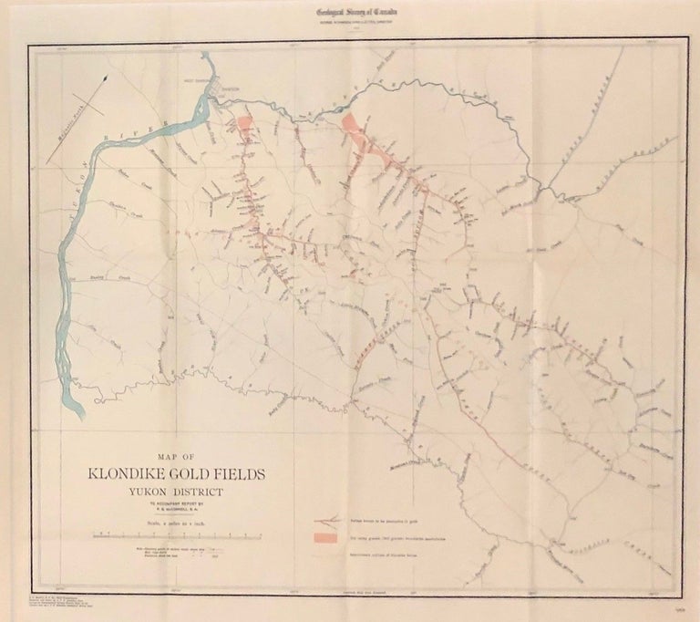
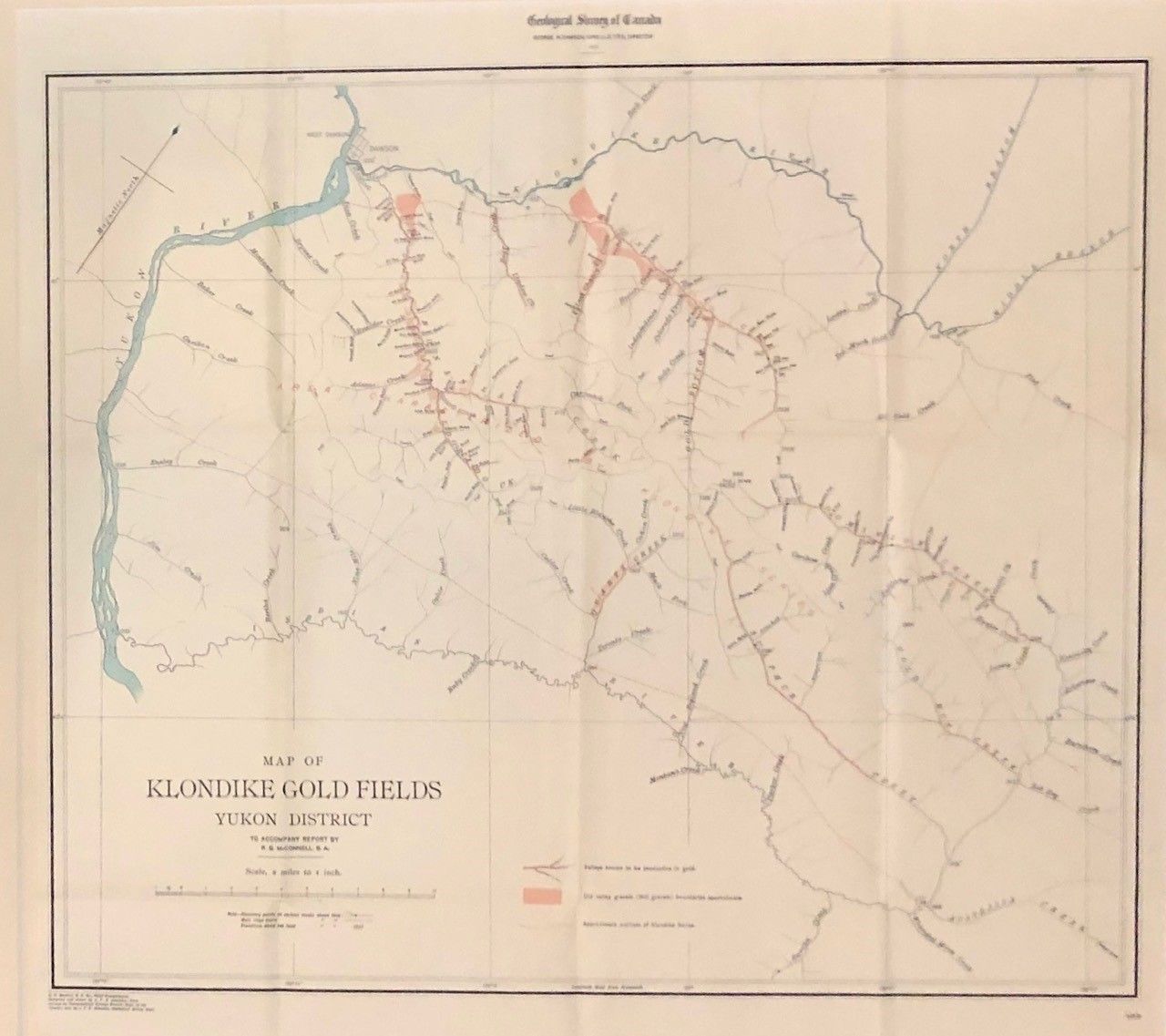
Map of Klondike Gold Fields Yukon District (from Preliminary Report on the Klondike Gold Fields Yukon District, Canada)
Ottawa: Government Printing Bureau, 1900. J. F. E. Johnston. First Thus. Framed under glass. Map documenting one of the most lucrative gold rushes in the history of mankind. Indeed, valleys that proved laden with gold highlighted in red ink. Scale presented as one inch = two miles. Map measures 22 1/4" x 20 3/4". Draftsman was C. O. Senecal, with map compiled and drawn by J. F. E. Johnston. Original folds present, but mellowed: A superb copy. Fine. Item #42
Richard George McConnell's report, to be included in the annual Geological Survey of Canada, of which this map was the key feature, was first published independently to meet miners' demand for the lay of the Klondike land. Aesthetically, an austere, handsome production that somehow conveys the chill of the north. See ARCTIC BIB., 10580; WICKERSHAM, 6773. Map can be shipped flat or rolled in a tube. Shipping costs to be established, with no surcharge for handling -- only actual shipping costs charged.
Price: $250.00