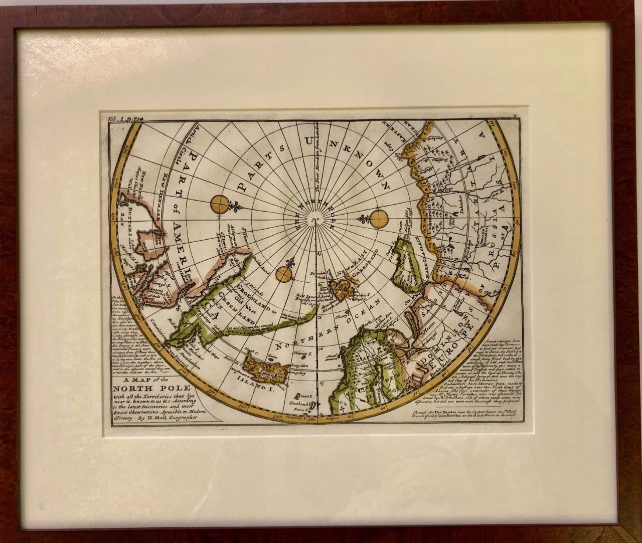
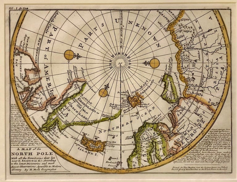
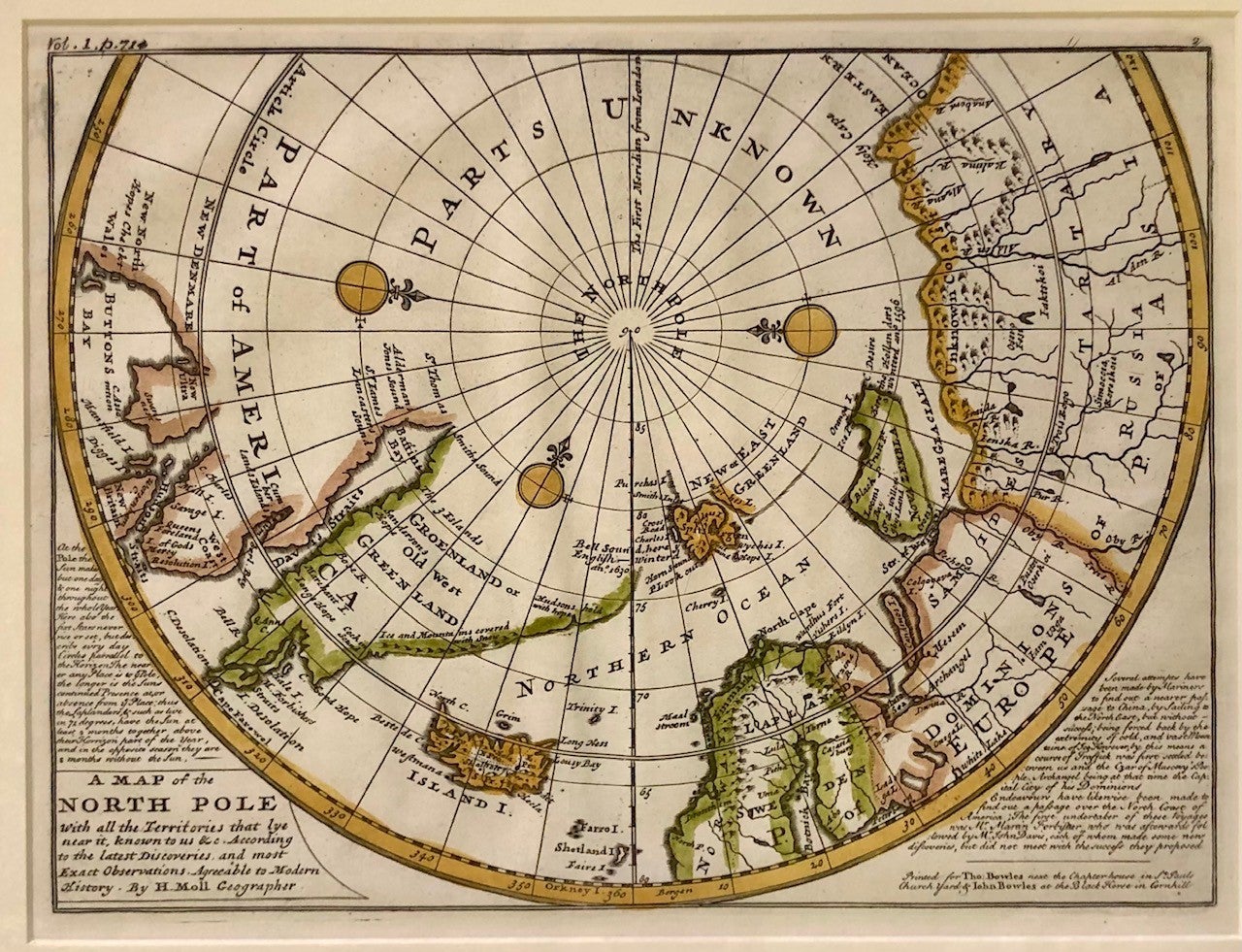
A Map of the North Pole with all the Territories that lye near it, known to us &c. According to the latest Discoveries and most Exact Observations Agreeable to Modern History
London: Herman Moll, 1730. Herman Moll. Framed Map. Framed, matted hand-colored map under glass with exposed area measuring 11.25 x 8.5 inches. Frame measures 16.5 x 14 inches. With the stamp of a NYC gallery on the frame's paper-backing, along with "ca. 1720" (sic) in pencil. Item #3581
A fresh example of Moll's map of the North Pole with commentary concerning the transit of the sun in the lower left corner, while the lower right corner outlines efforts to find efficient passage to China, thwarted by "extremity of cold and vast Mountains of Ice." Frobisher's discoveries are cited, as is Archangel, being "the Capital City of "the Czar of Muscovy's People" dominions. For more on the life of Moll, please see "The Cartographer and the LIterati: Herman Moll and His Intellectual Circle" by Dennis Reinhartz.
Price: $300.00